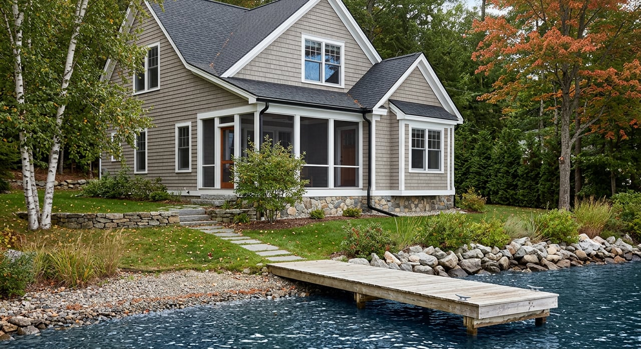
You can picture the view already: morning light on the water, a kayak on the shore, and family weekends that run on lake time. If you are planning a waterfront purchase in Benzie County, you are smart to do a little homework first. Shoreline rules, septic systems, and seasonal access can shape both your search and your budget. This guide walks you through what to look for, who to call, and how to buy confidently in Benzie’s lake and river markets. Let’s dive in.
Types of waterfronts in Benzie County
Lake Michigan shoreline
Lake Michigan frontage delivers big-water vistas and sandy beaches in places, but it also brings unique rules. Portions of the shoreline fall within mapped critical dune areas where vegetation removal and grade changes may need state review. Before you plan walkways or stabilization, check the state’s Critical Dune Atlas.
Along the Great Lakes, anything on or below the statutory Ordinary High Water Mark often requires permits. Docks, lifts, dredging, and seawalls typically need state review and sometimes federal review through the U.S. Army Corps. Start with Michigan EGLE’s guidance on Great Lakes construction permits.
Public trust rights allow pedestrian access along the Great Lakes up to the OHWM. That legal boundary can affect fences and structures, and it may shift with erosion or accretion. For background, review the Glass v. Goeckel decision explaining the OHWM and public trust.
Crystal Lake
Crystal Lake is a deep, clear inland lake and a centerpiece of local recreation. You will find active stewardship and aquatic invasive species prevention programs around its watershed. To understand local water quality monitoring and AIS response, explore the Crystal Lake & Watershed Association’s watershed management plan.
Platte and Betsie rivers
Riverfront homes offer canoeing, tubing, and fishing. Parts of the Betsie River are designated under Michigan’s Natural Rivers program, which sets structure setbacks and vegetation buffer rules within 400 feet of the stream. If you plan work near the Betsie, check the DNR’s Natural Rivers program before you buy.
Small lakes and ponds
Smaller inland lakes and ponds vary widely. Some have shallow, marshy edges or seasonal use patterns, and many have different boat or permitting profiles set by local townships or associations. Ask for association rules, local launch policies, and any AIS controls during your due diligence.
Key questions to ask before you buy
- Do you have true fee-simple frontage or shared access by easement? Confirm with the recorded deed, legal description, and any private road or association maintenance agreement. The county’s Register of Deeds is your primary source for recorded documents and covenants. You can start with the Benzie County page on deeds and recordings.
- Are shoreline structures permitted? Docks, lifts, riprap, and seawalls on Great Lakes shorelines often need permits. Ask for copies of any EGLE or USACE approvals tied to the parcel. Read EGLE’s guide on Great Lakes construction permits.
- Is the lot in a Critical Dune Area? If yes, even small projects may require a Vegetation Removal Assurance or permit. Check parcel status in the Critical Dune Atlas.
- Is it within a Natural Rivers corridor on the Betsie? That program changes setbacks and allowable work. Review the DNR’s Natural Rivers standards.
- What is the flood risk? Use FEMA resources to see if the property falls in a Special Flood Hazard Area. If it does, most lenders will require flood insurance. Learn more on FloodSmart’s flood zone guide.
- What is the status of the septic and well? Benzie’s rural waterfronts often rely on on-site systems. Ask for septic permits, last pump and inspection records, and any time-of-transfer evaluations. The Benzie–Leelanau District Health Department manages approvals and forms. Start with their on-site sewage program.
- Which utilities and services are available? Verify power, internet and cell coverage, and who plows the road in winter. Ask about seasonal dock removal and any bridge or culvert limitations for access.
- Are there rental or docking restrictions? Review township zoning, HOA rules, and recorded covenants. The county’s permitting guide is a practical reference for local processes and contacts. See the Benzie County planning and permitting guide.
How to read a listing
Look for clues that tell you a property needs extra evaluation.
- “New shoreline improvements” or visible riprap may mean permits were required. Ask for EGLE permit numbers and engineering reports.
- Mentions of dunes, steep bluffs, or beach stairs can indicate Critical Dune Area status. Verify in the state atlas before planning changes.
- “Betsie River frontage” should trigger a Natural Rivers check for setbacks and vegetation rules.
- “New septic” is positive, but still request the health department permit, site survey, and final approval to confirm system type and future expansion limits.
- “Private road” suggests shared maintenance. Ask for recorded road agreements and current costs.
Inspections and records to get before closing
Order inspections early so you have time to react.
- Septic system: full inspection, dye test if recommended, and review of health department permits and site evaluations from the Benzie–Leelanau District Health Department.
- Well and water: well log, performance, and lab tests for coliform and nitrate. Consider arsenic screening if recommended locally.
- Structural and shoreline: focus on foundations, any flood or ice damage history, and bank stability. If armoring exists, ask a shoreline engineer to assess performance and permit history.
- Survey: show property lines, any recorded easements, the Ordinary High Water Mark where relevant, and structure setbacks.
- Elevation information: if flood risk is possible, consult your surveyor or insurer about an elevation certificate.
Seasonal ownership
Benzie County thrives in late spring through early fall, with peak activity around boating season and the fall color period. Expect busier boat launches and river corridors on warm weekends. If quiet time matters to you, plan off-peak visits when you tour.
Winters in northern Michigan require planning. Confirm year-round road maintenance, snow removal responsibilities on private drives, and where you will store or remove docks and lifts. Ask for utility bills and insulation details to understand winter carrying costs.
Water quality nuisances can appear seasonally on inland lakes. Local associations monitor conditions and coordinate mitigation for issues like nuisance weed blooms. Crystal Lake’s community programs are a good model of how lakes organize water quality and AIS response through their watershed management plan.
Ownership costs and insurance
- Septic systems: routine pumping is modest, but replacements vary widely with soil and system type. Complex systems can run into the mid or high five figures. For a general overview, review this guide to septic system costs, then get local estimates.
- Shoreline protection: engineered revetments and seawalls on Lake Michigan require permits, and costs can be significant. Always verify permit status and design with EGLE’s Great Lakes construction permits.
- Flood insurance: if FEMA maps place the parcel in a Special Flood Hazard Area, lenders will likely require a policy. Learn how zones affect requirements on FloodSmart.
- Taxes and assessments: waterfront typically carries higher assessed values. Check the current tax roll, special assessments, and recorded projects with the county treasurer and the Register of Deeds.
Who to call locally
Use these agencies and associations early in your due diligence.
- Michigan EGLE coastal staff for docks, seawalls, and Great Lakes projects: Great Lakes construction permits
- Michigan DNR for Betsie River setbacks and standards: Natural Rivers program
- Benzie–Leelanau District Health Department for septic and well approvals and transfer forms: On-site sewage program
- Crystal Lake & Watershed Association for AIS and water-quality programs: Watershed management plan
- County planning and local zoning for permits, road agreements, and township contacts: Benzie County planning and permitting guide
- Register of Deeds for recorded easements, covenants, and legal descriptions: Benzie County recordings
Why local expertise matters
Every lake, river, and township in Benzie operates a little differently. A knowledgeable local agent can help you pull permit files, coordinate septic and well inspections, and read between the lines of listings so you avoid surprises. You also gain access to vetted shoreline engineers, dock builders familiar with EGLE and USACE requirements, and local health department contacts who keep your timeline on track.
If you are ready to explore waterfront opportunities, reach out to a team that blends regional roots with hands-on guidance. Connect with Christina Roberts to start a focused, stress‑smart search.
FAQs
What makes Benzie County waterfront buying different from other areas?
- State and local rules around Great Lakes shorelines, Crystal Lake stewardship, and Betsie River setbacks add steps to due diligence, so permits and records matter more here.
How do I know if a Lake Michigan lot is in a Critical Dune Area?
- Check the parcel in EGLE’s online Critical Dune Atlas and confirm with local zoning before planning any vegetation removal or grade changes.
Do I need permits for a dock or seawall on Lake Michigan?
- Most projects on or below the Ordinary High Water Mark require state permits, and some also need federal review, so verify permit history before you buy.
What septic documents should I request for a rural waterfront home?
- Ask for the septic permit, last pump and inspection records, any time-of-transfer evaluation, and the site survey or percolation results from the local health department.
Will my lender require flood insurance for a Benzie waterfront home?
- If FEMA maps show the property in a Special Flood Hazard Area, most lenders will require flood insurance; ask your insurer and consider an elevation certificate.